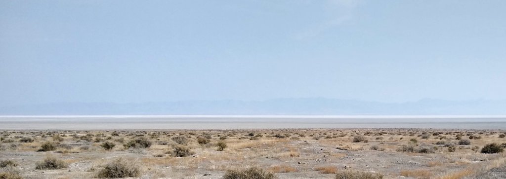
The Great Basin covers most of Nevada and parts of Utah, Oregon Idaho and California. It’s unique because none of the water that flows into the basin ends up in an ocean. It sinks into the ground, flows into lakes, or evaporates – leaving flat, featureless dry and salty lake beds between the many mountains. It’s mostly desert, but much different from the more southern Sonoran and Chihuahuan deserts.
In past road trips, we’ve crossed the basin and skirted around the edge several times but never deliberately sought to travel too the basin. I’d heard that the Great Basin National Park was one of the least visited National Parks and decided to make it a destination.
We were in the area a year ago late September and early October, but below freezing weather discouraged us from heading north to the park. This year we’ve hit warm (or hot) weather, so the high altitude of the mountains was attractive.
Heading west from the Scipio, Utah area on Rt. 50 we crossed several stretches of desert, a couple of mountain ranges, and skirted the northern edge of the Sevier Lake playa – a dried up remnant of the ancient Lake Bonneville.
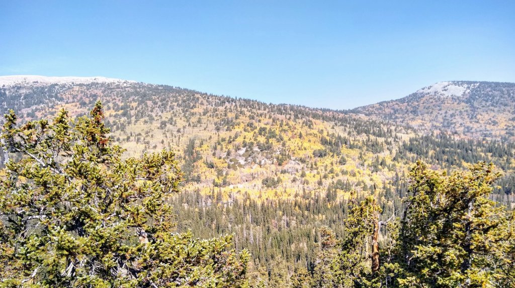
The Great Basin National Park was busy – the campgrounds were full, the trails were crowded and trailhead parking lots were full. Certainly didn’t seem like one of the least busy parks in the US. And as with much of the west this year, the park is blanketed in haze and smoke – to the extent that the grand vista’s on the road to the Bristlecone trailhead weren’t very grand. The leaves on the aspen were starting to turn, so there was a bit of color showing through the haze.

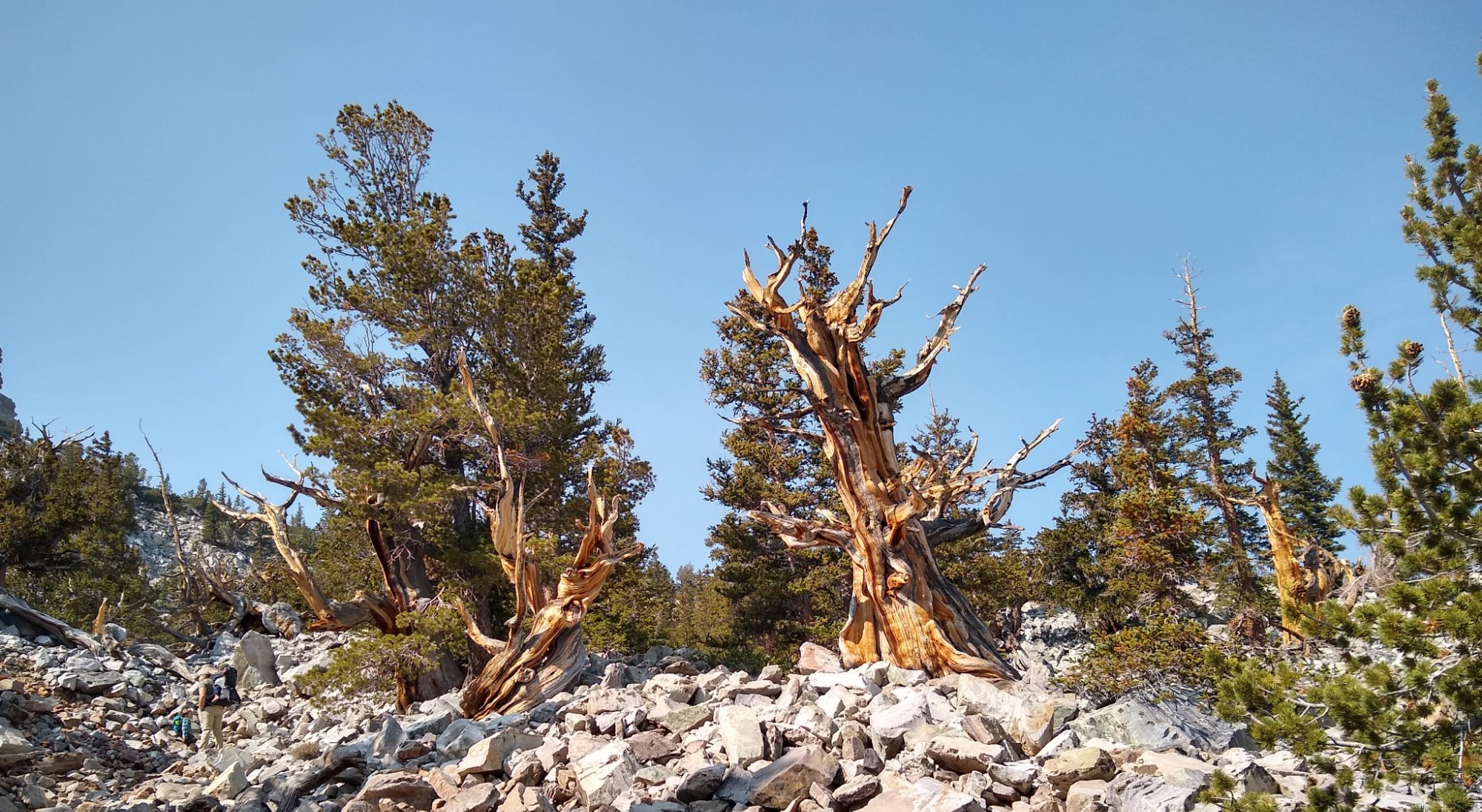
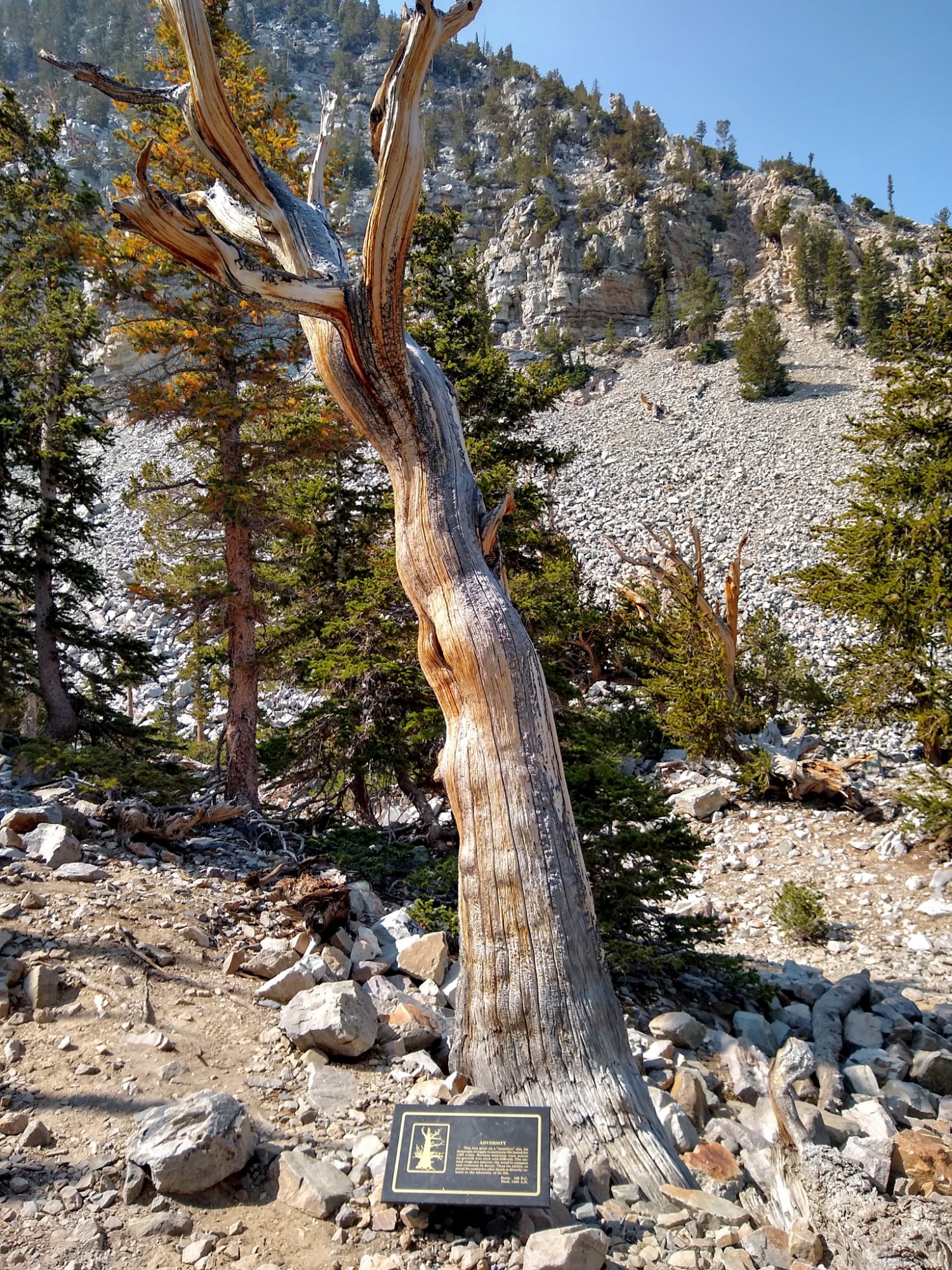
The trail to the bristlecone pine grove was a worthwhile hike. The grove is a stand of pines that have survived thousands of years of harsh weather. The trail is 3 miles round trip at 10,000 feet altitude. We don’t hike at altitude much and could tell that we weren’t at a Minnesota-like 1000 feet.
The campervan did OK on the 12 miles of 8 percent grade up the bristlecone trailhead, but got beat to heck on the 3 miles of washboard gravel on the road to the campground. It was one of those roads where you either go 5 mph and waddle across the bumps, or 40+ mph and fly across. I tried the latter and ended up with all six tires on my 9000 lb. campervan simultaneously airborn. The result was a sideways displacement of about a foot for the van, and and a random displacement of pretty much all of our dishes and loose gear.

We’re heading back east now, trying to hit a few spots we missed last year. We’ll be able to add a few more dots to our travel map.

Leave a comment