After a couple of nights in the southern unit of Theodore Roosevelt National Park we drove the seventy-five miles up to the northern unit and camped for the night. Another hot and dry day, with temps over 90F in the late afternoon.
The northern park is much quieter, with fewer campers and far less traffic. The scenery is just as nice, with spectacular views of the Little Missouri River valley, the cottonwoods, and a geology of eroded hills exposing their layers of browns and grays.
Along the park road there are several river valley overlooks, some of which are best at either sunrise or sunset.
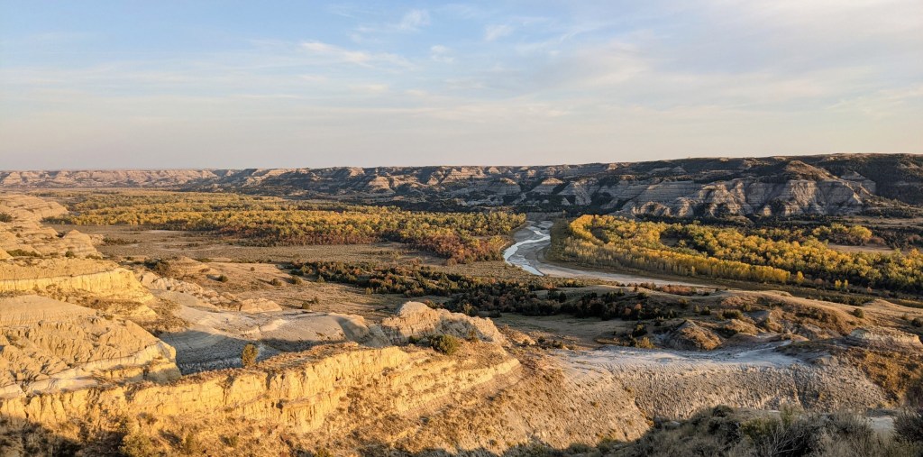
The view from the River’s Bend overlook is the nicest. It’s supposed to be the view that caused this part of the park to be designated as National Park. The Little Missouri River meanders through its valley, with cottonwoods lining the bank. Fall is nice here, and I’ll bet spring would be really nice too.
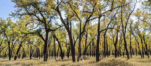
We accidentally hit the park when the cottonwoods were turning yellow. In this grove near the campground, the sun shining through turned the leaves translucent. I hiked around in the grove looking for the right light. I was thinking of bright yellow leaves against jet black trunks, with no other distracting colors. This is as close as I could get.
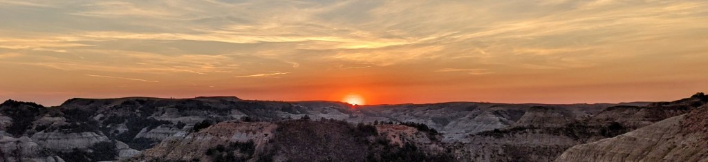
Too hot and too many blackflies in the campground, so we headed back to the River’s View overlook and waited for the sun to set and the air to cool. We thought we might get lucky and catch a decent sunset from that overlook.

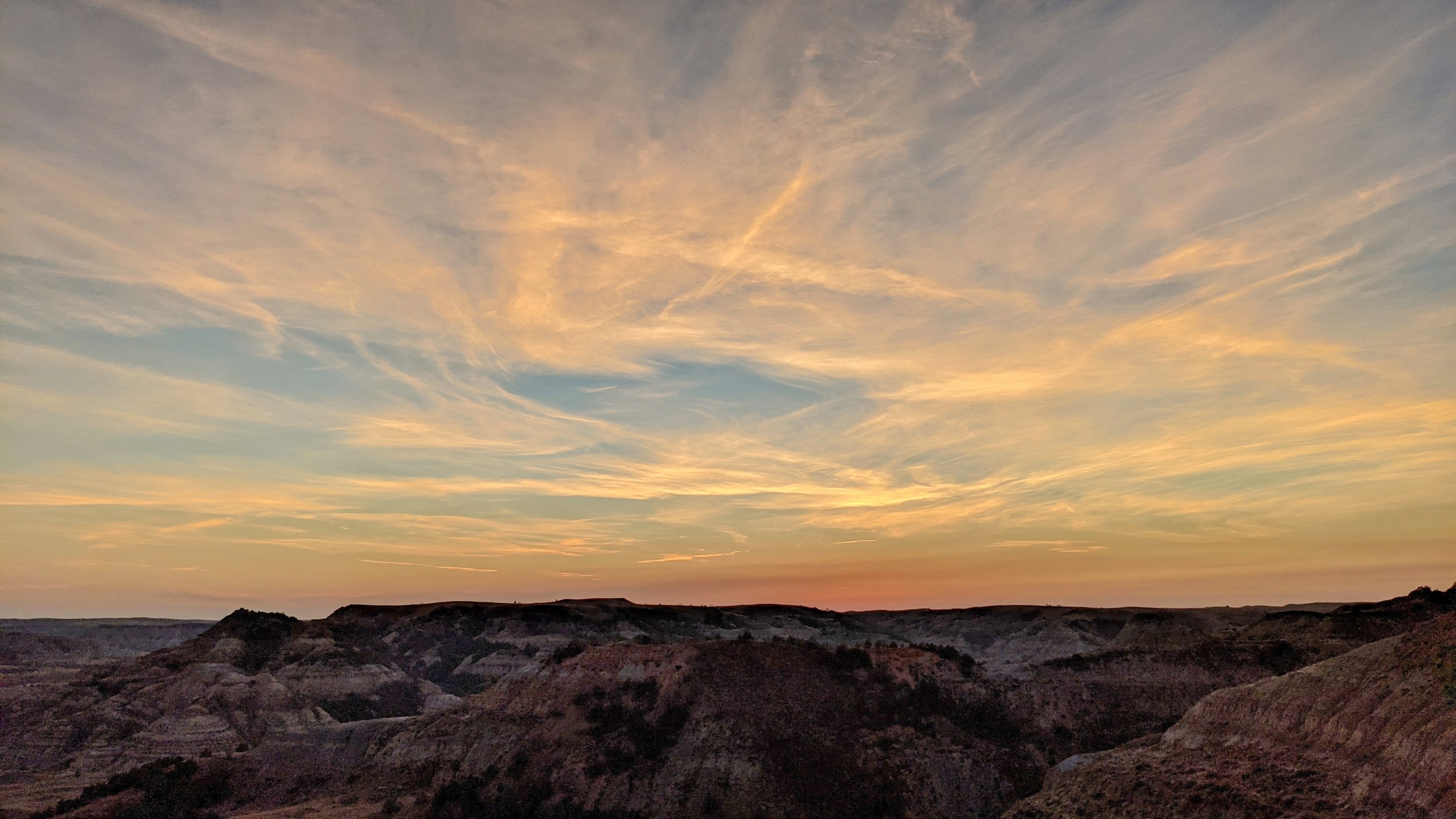
We did, sort of.
From the National Park we headed north, trying to get as close to Canada as possible. I figured that the closer to the polar ice cap, the better chance of escaping the heat. Didn’t help much. We still had 90F up by the border. I suspect the ice cap receeded as fast as we drove, taking the cool air with it.
This is our first time through the Bakken oil field where the shale oil play has been a big deal for the last decade or so. Pumpjacks everywhere, oil field trucks on the highway, small towns with big oil related service companies, etc. An interesting mix – severely eroded badlands, rolling range land, pothole prairies, and pumpjacks.
Tonight we’re in a North Dakota State Park (Lake Metigoshe State Park) near the Canadian border. We had spent a few hours at the J Clark Salyer National Wildlife Refuge, where we observed that there was more wildlife outside the refuge in the small roadside ponds, sloughs and glacial potholes that dot the prairie than there was in the refuge. Perhaps better signage would guide the wildlife to the refuge? They seem to have gotten lost.
There’s a bit of birch/aspen hardwood forest and a resort-oriented chain of lakes in the part of North Dakota where we are staying tonight. It’s sort of like a bit of northern Minnesota plopped into the middle of the prairie. A nice change of scenery from prairie, hay bales, and pumpjacks.
Heading east tomorrow, back towards home. Rumor has it that a cold front will overtake us along the way.

Leave a comment