
Update: I found out from a friend who lives nearby that the bog was also used as a bombing range during and after WWII.
A long-gone glacial lake; hundreds of square miles of lowlands, swamps and peat bogs; stolen land, a massive drainage project, land speculation; failed farms and government bailouts … this is a bog with stories to tell.
The story goes something like this. The glaciers retreated and left behind a big lake – more than a hundred thousand square miles of Lake Agassiz. As the glaciers retreated north the big lake filled with sediment and eventually drained, leaving behind a whole bunch of flat land.
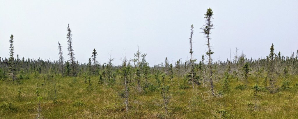
A bunch of that flat land ended up as peat bog. Hundreds of square miles of peat bog.
Fast forward 10,000 years or so. The government tried to turn the peat bog into something useful. Step one was to ‘appropriate’ the land from the local tribes and offer it to settlers – a routine transaction at the time. A poorly engineered County drainage project convinced settlers that the land could be farmed The county thought that farmers speculators would pay off the debt from the drainage project.

Nope. Not farmable. Lots of debt.
In the eternal battle between humans and nature, nature won. For once.
Somewhere along the line someone decided that federal government should bail out the farmers, the State should bail out the counties, and that a few million acres of hunting land and wildlife preserve would be a better use of the land.
So now we have a big bog, an attempt to undo the damage caused by the ditches, and a really unique bit of natural goodness preserved for the future.
The State designated the as a Recreation Area, and in 2005 built a mile long boardwalk that takes you through the tamarack and spruce, across a patch of muskeg, with a chance to see meat eating plants, rare orchids, and other miscellaneous oddities. Certainly worth seeing if you are anywhere near this part of Minnesota.

There are a couple other trails starting from the boardwalk trailhead. The ‘Old Caribou Camp Trail’ was maintained and partially marked. The ‘Marsh Vista Trail’ section north of the parking area is maintained, but poorly drawn on the map. You access it from a snowmobile trail that crosses the parking area, not from the Pond Trail. There’s not much to see on that trail though. It’s like someone let a kid drive a brush mower around the woods for a few hours – to no particular purpose.
The south section of the Marsh Vista Trail can be accessed from it’s intersection with the Caribou trail. It’s neither maintained nor marked, and disappears into the woods after a few hundred yards.
I got to where the trail disappeared. Taking stock of the situation – at the edge of near-infinite trackless bog-land, no compass, no knife, inaccurate maps, no bug spray, two swallows of water and a handful of raisins – left me somewhat shy of embarking on a great adventure, so I gave up in the idea of bushwacking my way around ’till I found the rest of the trail.
Oh well. Maybe next time. 😀

Leave a comment