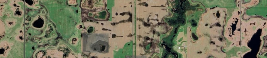
There is a stretch of the Northern prairie that was originally covered with small ponds, wetlands & lakes left over from the retreating Wisconsin Glacier – I.E. potholes. I guess that makes this a ‘pothole prairie‘. The glacial remnants cover southern Alberta, Saskatchewan, and parts of Manitoba, Montana, North & South Dakota, Minnesota and Iowa.

The area just north of Devils Lake is the best remaining example that I’ve run across. Nearly every square mile of prarie in this area is dotted with a handful or more small, shallow ponds ringed with cattails, surrounded by farmed fields.
The potholes vary in size from a quarter acre on up, and are neither fed from nor drained by streams. The water comes from snow, rain or groundwater. This time of year, the small ones are dry.

I’ll bet the power steering on the farmers tractors gets a workout on those fields.
I suspect that much of western Minnesota was like this too – but in that part of the state you can’t drive more than a couple of miles without crossing a county maintained drainage ditch, and after harvest, the tile trenching machines that make sure that wet potholes are all drained and plantable. For some reason that’s not being done in this area. No idea why.
It’s duck-city here too. According to Wikipedia, half of the waterfowl in North America migrate through the pothole prairie region. Various conservation groups claim that millions of ducks breed here, and that the pothole region is decreasing in size every year.
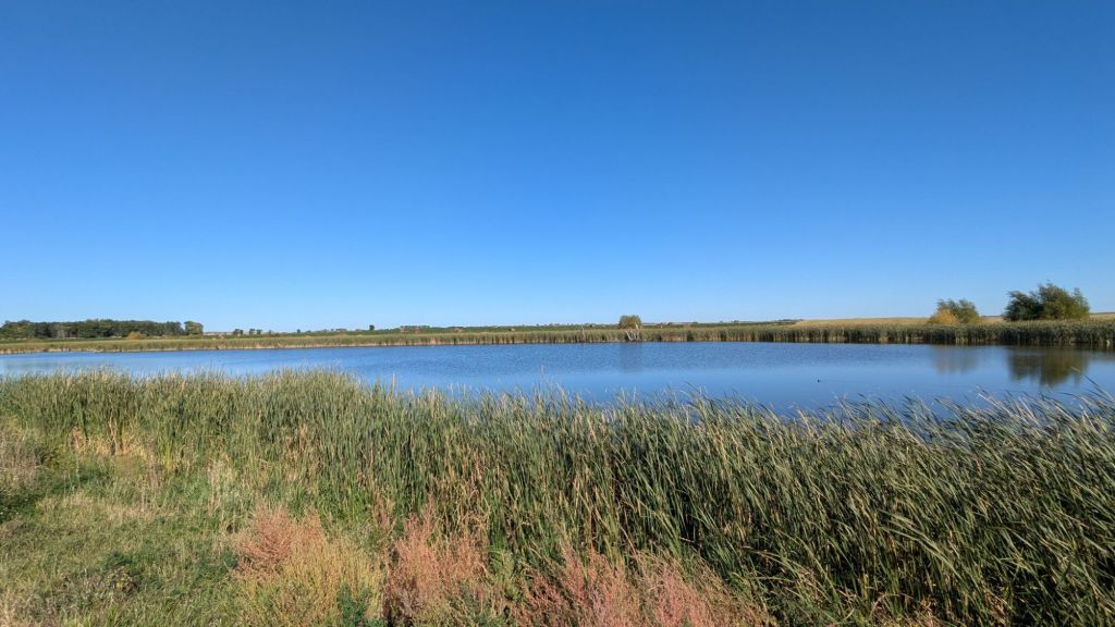
Arrowwood National Wildlife Refuge
One the way back toward Minnesota we stopped at the Arrowwood National Wildlife Refuge. We drove the refuge’s short auto tour, but this time of year and with 20 – 40mph winds, wildlife was sparse. Could be decent at the right time of the year though.

Home
One more day or driving and we’ll be back home. It’ll take at least a day to clean up the campervan – we picked up lots of mud and dirt out in Montana. Then figure out what to tweak for the next trip.

Leave a comment