We’re in N. New Mexico, having spent a few days camping at Bandelier National Monument. The Monument preserves the remains of an ancient Pueblo civilization that lived, farmed, and hunted in the area of the Pajarito Plateau.
The Pueblo people lived in dwellings carved into the soft volcanic rock (tuff) and built from blocks of tuff. The Frijoles Canyon dwellings were occupied from roughly 1100CE to 1500CE.
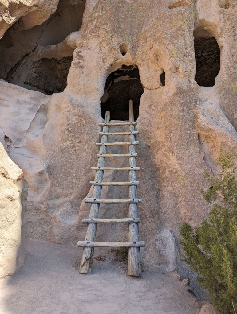
Multi-story dwellings were built by setting the floor supports into carved holes in the cliff walls.
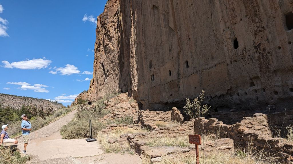
Much of the Pueblo ruins are accessible via a short walk from the visitors center, as is a trail leading to a nice waterfall. It’s hard to see in the picture below, but there is a waterfall back in the shadows. If I’d have waited another hour the waterfall would have been lit by the sun. I didn’t wait.

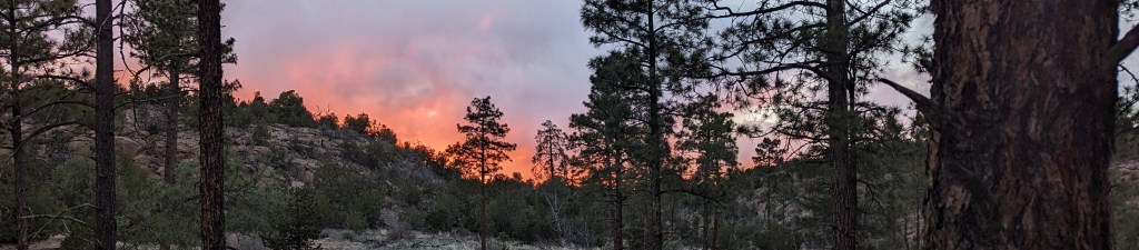
The campground is up on the plateau, overlooking the canyon. The view from the road near the campground is quite nice.

We also drove up to the Valles Caldera National Preserve. It’s what’s left of a collapsed million year old volcano, now a series of alpine meadows. It’s too early in Spring for anything to be greened up, and without the reservation and permit necessary to take the backcountry auto tour, there wasn’t much to see. To hit the caldera at the right time and get to see the backcountry, I’d have to plan ahead. Not likely to happen.
Heading east from Bandelier, we crossed the Sangre de Cristo mountains on US Hwy. 64 from Taos through Eagle Nest towards Cimmaron. It’s a beautiful route set in the bottom of canyons on both sides of the summit. Great scenery. Lots of 20mph curves.
Another observation (or rant) on mapping software. We have a regular Garmin GPS and use Google Maps at the same time. Google will send us on all kinds of loony-tunes routes – ungraded sand & dirt township roads, washboard gravel roads, narrow city side streets, crappy sencondary (or tertiary) roads just to save a minute of travel time. On many legs of our trips, Google tries to send us on really dumb routes. Garmin, on the other hand, will always route to the nearest major highway, stay on the main roads as long as possible, then route onto secondary roads as close to the destination as possible. On this leg, Garmin kept trying to send us on a lengthy detour through Santa Fe, apparently because it didn’t want us crossing the mountains on US 64. Google was happy to send us over the mountains.
That’s why we always verify with a paper roadmap of some sort.
We’re currently camped in Cimmaron Canyon State Park, alongside a small river at the bottom of the canyon. Nice place.
Heading back to Oklahoma tomorrow. Back home next week.

Leave a comment